Local Space Map
Local Space Map is not available in the Lite version of ZET.
The "Local Space Map" function is a variant of Local Space Astrology for nearest surroundings, e.g. apartment, city, and so on.
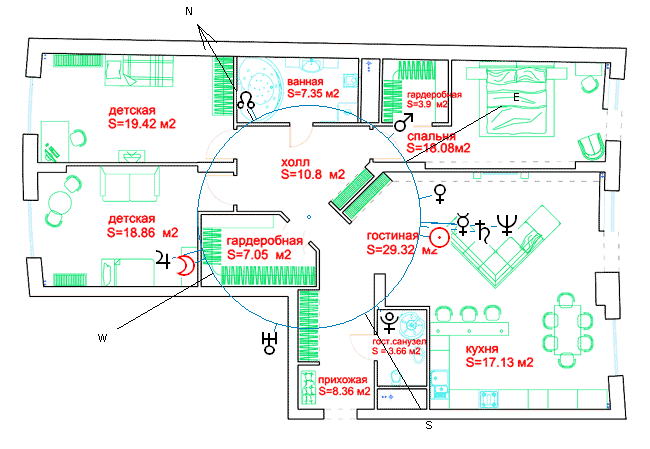
To draw the Local Space Map you should do following:
- Get a draft of apartment (or map of city) as a BMP-format image file.
- Setup a horizontal coordinate system (Chart Settings, Zodiak).
- In case of dual chart to switch off the "Horizon of first chart" option.
- Specify the path to image file. See "Chart Settings", "Misc.(5)" tab.
- Switch on a "Local Space Map" option.
- Locate at the screen a centre of planet's ring to a center of image (the center of apartment or your location in current area) by drug-and-drop a planet wheel or by chart positioning tools at "Size" tab.
- Get orientation of an image by compass or any other (north-south direction). If you use a magnetic compass, you should check on the "Consider Magnetic Declination" option.
- Set this orientation of planet's ring on the image. See Chart Settings, Format tab, East of wheel. Input desired degree.
- Set other desired settings, e.g. size, font, and save it as a configuration (the "Configuration" button, "Save configuration" menu item).