Search areas of events realization
Function of search of areas of realization of event allows to find places on globe, where takes place the astrological event, satisfying to some criterion. The search result will appears as the shaded areas on a geomap, For example:
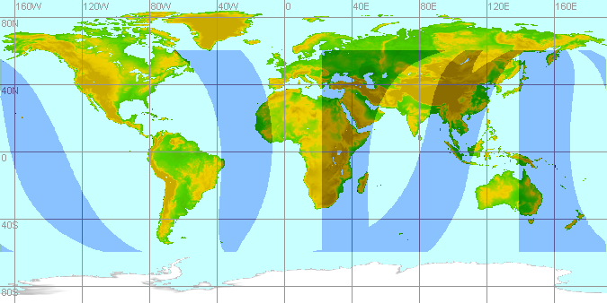
Function can be applied, for example, for the relocation technic to define of a place favorable for realization of any theme of native's life, places recommended to move on a constant residence or for a some time. Or vice-versa, to recognize areas not acceptable for this native.
The window "Search areas of events realization" invoiced by appropriate item of popup menu of geomap tableau:
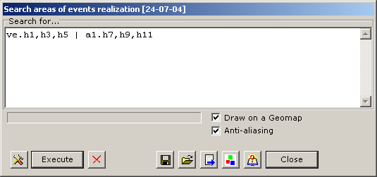
Make the following:
- In the field "Search for..." field enter the formula describing demanded criterion.
For example, the formula specified in drawing above, means
"Venus located in the 1st, 3rd or 5th house, or almuten of the first house located in
the 7th, 9th or 11th house".
How to write down this formula, read the Astroformula Language chapter.
After you input the formula, check it's correction by clicking the
 "Check formula's sintax" button.
In all right, then should appears "Π" sign. In other case, will appears a message with diagnostic of error.
For start of process of search press "Search" button. Watch process on the indicator of search and messages under the indicator.
If necessary to interrupt search process press the button with a red cross.
Duration of searching with the formula mentioned above, makes approximately 15 seconds on the middle-level computer. You may check off the "Anti-aliasing" option to speed up to 2-3 times.
For special purposes may be demanded additional settings. To do that click
 "Settings" button.
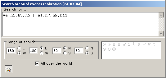
On the appeared panel it is possible to set search area (by default the whole world), and also, to set objects which should pay off in the course of search. These objects may be the Moon in topocentric system (in this system the astronomical coordinates of the Moon considerably depend on geographical coordinates of a place), and also, lots (depending on houses). These objects are activated by clicking or mouse moving in a corresponding field.
Results of calculation can be kept in a file, for this purpose click
 button and follow standard dialogue.
Subsequently the data can be restored, for this purpose click
 button and choose the necessary file.
Last kept file is restored automatically when this window opend,
and the areas of realization of event appears on a geomap
(if the option "Draw on a geomap" checked). A name of a current file
is displayed in window heading in square brackets.
button and choose the necessary file.
Last kept file is restored automatically when this window opend,
and the areas of realization of event appears on a geomap
(if the option "Draw on a geomap" checked). A name of a current file
is displayed in window heading in square brackets.